You are here: \ Shared Services \ Geospatial Projects and Services \ PGF WLASS LiDAR Project
You are here: \ Shared Services \ Geospatial Projects and Services \ PGF WLASS LiDAR Project
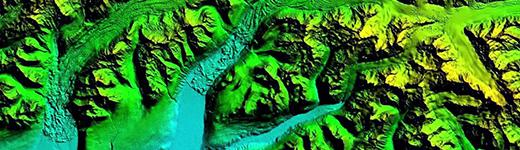
A LiDAR (Light Detection and Ranging) survey collects precise laser measurement of the earth surface. The resulting data is used to create highly detailed 3D maps and models of the landscape.
The data enables better management of natural hazards, such as flooding, erosion and sea level rise. It provides farm-scale land information to benefit the agriculture and forestry sectors as well as being used for many other planning purposes. It’s also widely used for development, engineering, architecture and design applications by the private sector.
In April 2020, Co-Lab entered into an agreement with Ocean Infinity (previously named iXblue Pty Ltd) to complete a LiDAR survey throughout the Waikato region.
The survey was completed in April 2021 and the mammoth task of processing the data then commenced. After intensive quality control, the first set of highly accurate 3D mapping data was released in 2023.
Co-Lab, on behalf of the 10 participating councils, has secured funding of $1.4 million from the Provincial Growth Fund (PGF) and approximately $133,000 third party funding for the region. Co-Lab is leading the project which is part of a national LiDAR programme coordinated by Land Information New Zealand (LINZ).
Co-Lab is also grateful for the contributions from the following organisations who co-funded the initiative: WEL Networks, Environmental Research Institute, EQC – Earthquake Commission, Waikato River Clean Up Trust, Lincoln Agritech and Mercury NZ Ltd.
More information about the LINZ national elevation programme, including the PGF LiDAR project is available from the Elevation Aotearoa site.
The Waikato LiDAR data can be found on the LINZ Data Service.
Co-Lab, in conjunction with Waikato Regional Council (WRC), proudly entered the 2025 Taituarā Awards under the Award for Excellence in Collaborating for Results category.
While the entry did not take home the top prize, it was recognised as a strong example of cross-agency collaboration and digital innovation.